Geohazards Exploitation Platform
Reposted

In line with GEP compliance to #FAIR principles for reproducibility, discoverability
& scalability, @terradue brings FAIR to ML Models, adopting Machine
Learning Operations (#MLOps) for GEP users to build, deploy, and monitor
models for ground motion monitoring.


a day ago
Geohazards Exploitation Platform
Reposted
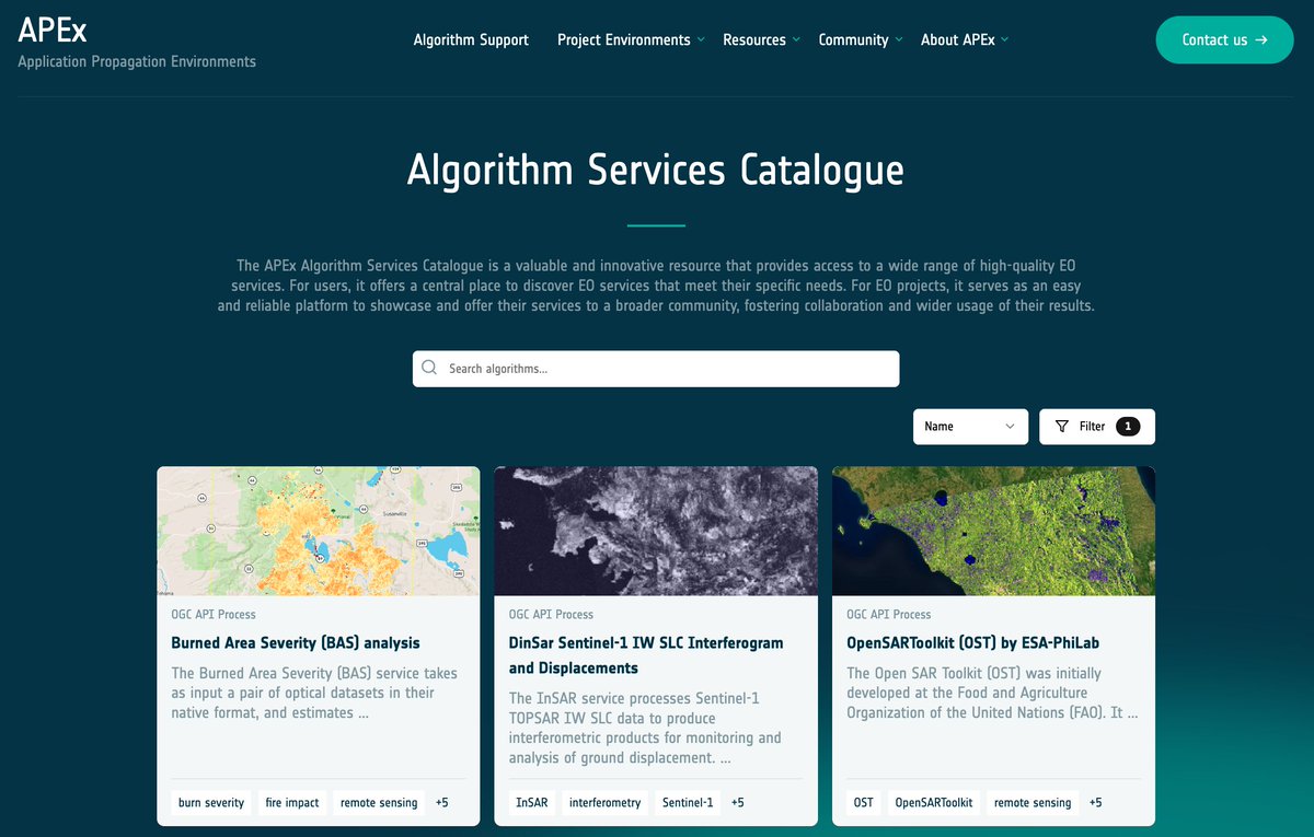
Some additional context to the APEx Project Environments
being demoed this week at #BiDS25:
We've engaged with registering GEP hazard mapping services on the APEx Algorithm Services catalogue.
➡️a central place for APEx users to discover EO services that meet their specific needs https://t.co/9XoL80D44Y
Oct 2

Very interesting opportunity related to building damage
assessment !
"AI for Earthquake Response" Challenge
✅Gain access to a curated archive of multi-mission, HR satellite imagery
✅ Build machine learning model
Registration:
https://t.co/Ji3ufqdwnY
Launch on 4th July 2025
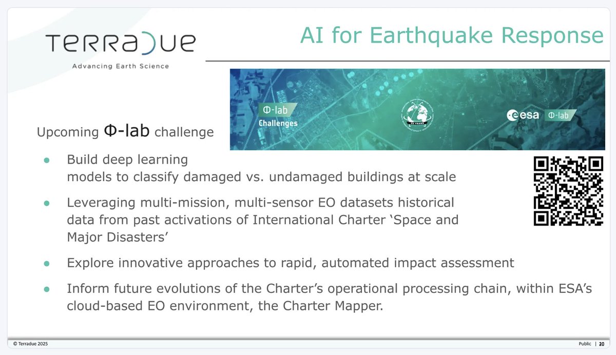
Jun 30
Geohazards Exploitation Platform
Reposted

project partners, platform users, algorithm providers,
stakeholders, managers, standardization experts, system integrators, PhD students, researchers,
startup founders
We serve the Earth Science communities
https://t.co/pErxDlhVoK
Jun 27
Geohazards Exploitation Platform
Reposted
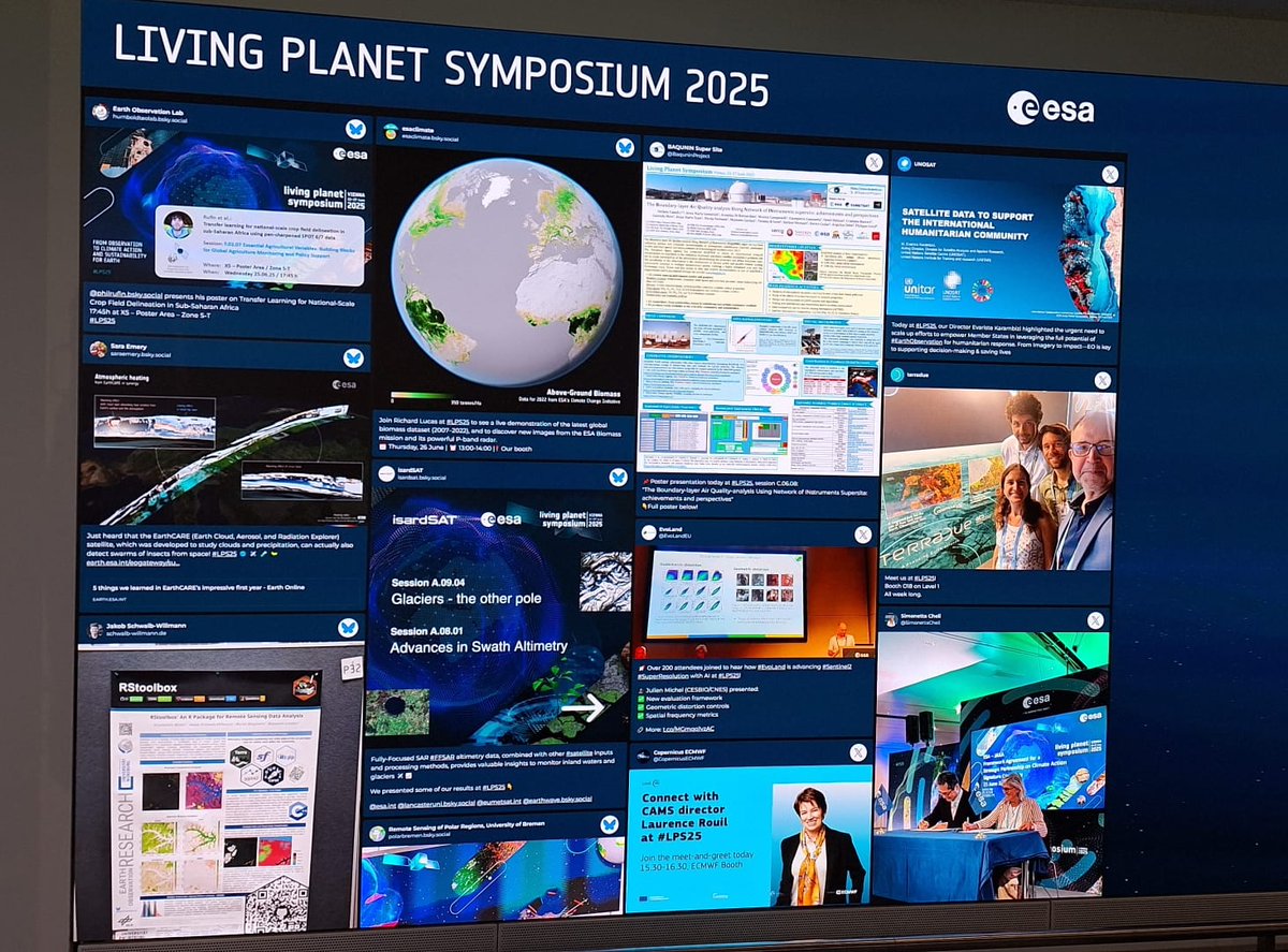
We had a such a nice time as exhibitor at #LPS25
Many thanks to the event organizers @ESA_EO
Many thanks to the participants who came to see us.
It was GREAT to be in Vienna ! https://t.co/jmfh3Q214W


Jun 27
Geohazards Exploitation Platform
Reposted
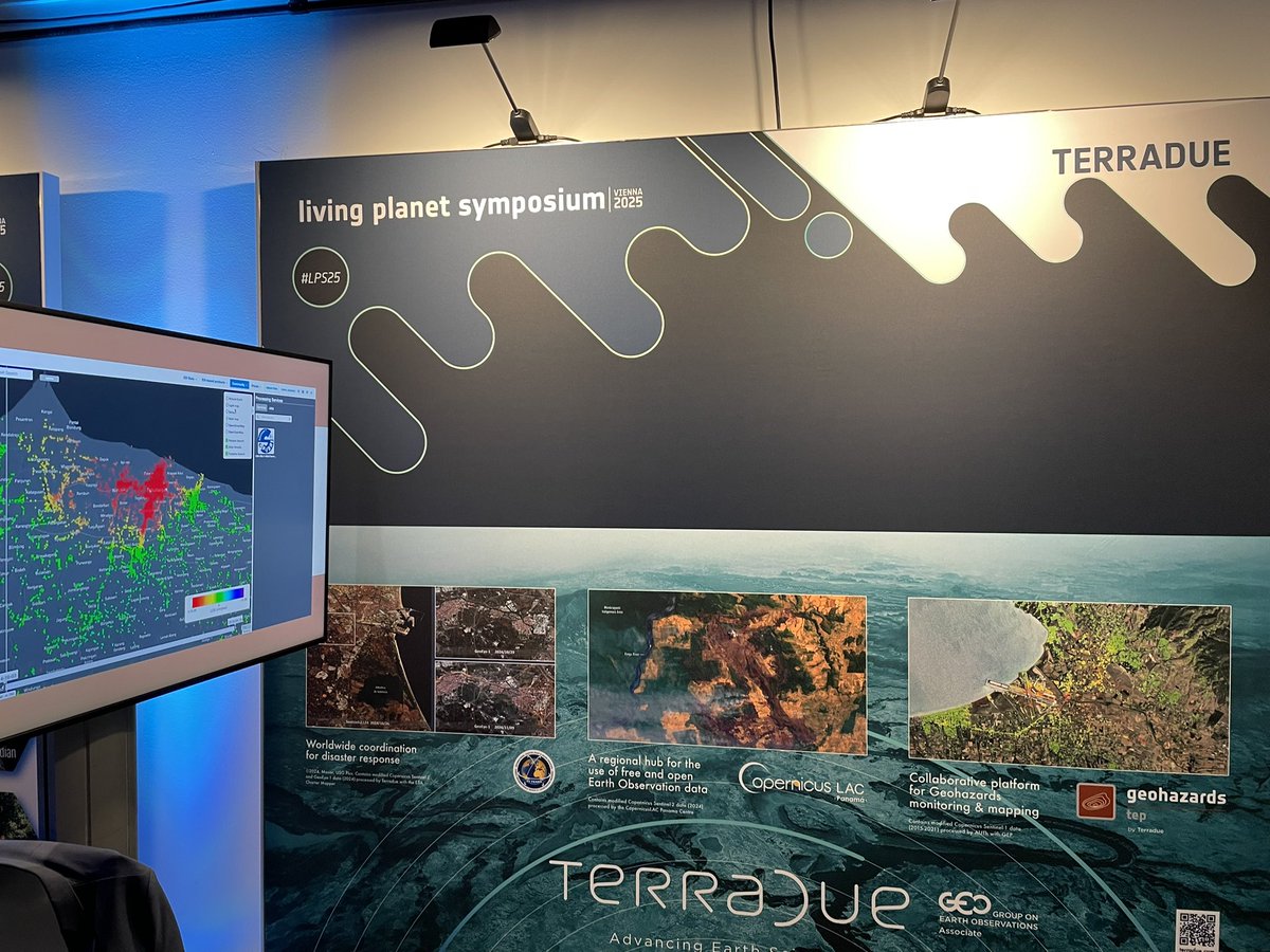
Running week at #LPS25
We are at Booth O18 on Level 1
All for Earth data, open science and algorithm portability https://t.co/2IYGVAL0vI

Jun 25
Geohazards Exploitation Platform
Reposted
Next week, we'll be present at the @ESA_EO Living Planet Symposium 2025 #LPS25, in Vienna, Austria.
🌍We’re thrilled to be part of the dialogue shaping the future of EO science and technology.
https://t.co/2hVJG1qD3G
Jun 20
Geohazards Exploitation Platform
Reposted
Horizon Europe for a sustainable future: the #Mining sector innovates through digital innovation and
Earth Observation
https://t.co/FKm0dp9swu https://t.co/Dq6v62lndU

Jun 2
Geohazards Exploitation Platform
Reposted
GEP update: global impact, institutional adoption and
new commercial offer, the platform supports a broad range of users, from Research to Operations
https://t.co/gB393jZsJq https://t.co/6Lc7hxhIN7
May 6
On the Blog: Responding to the #Myanmar #Earthquake with Sentinel-1 observation
https://t.co/IegbtsFJUX
Apr 3
Geohazards Exploitation Platform
Reposted

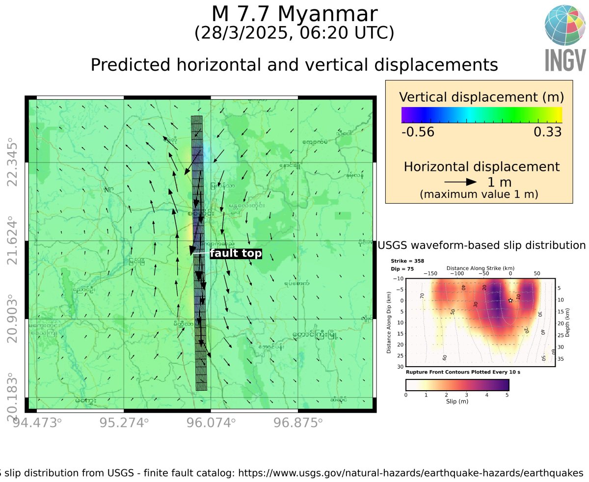
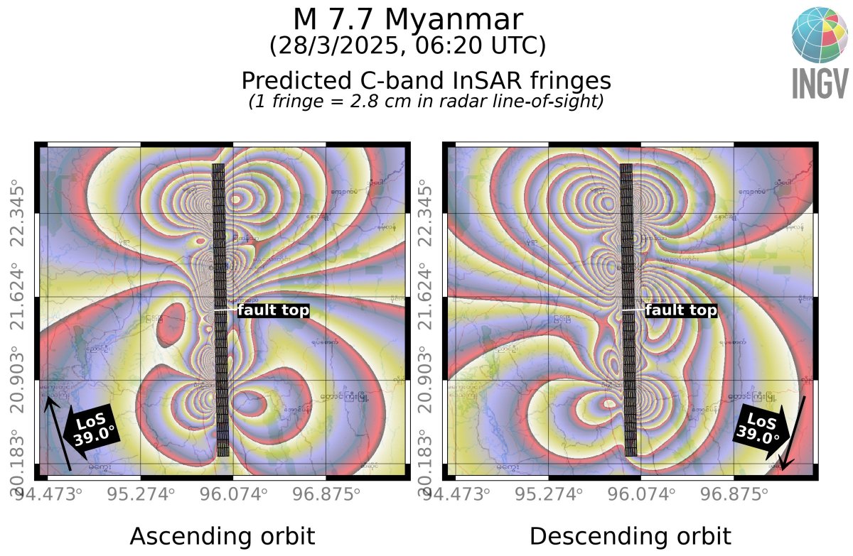
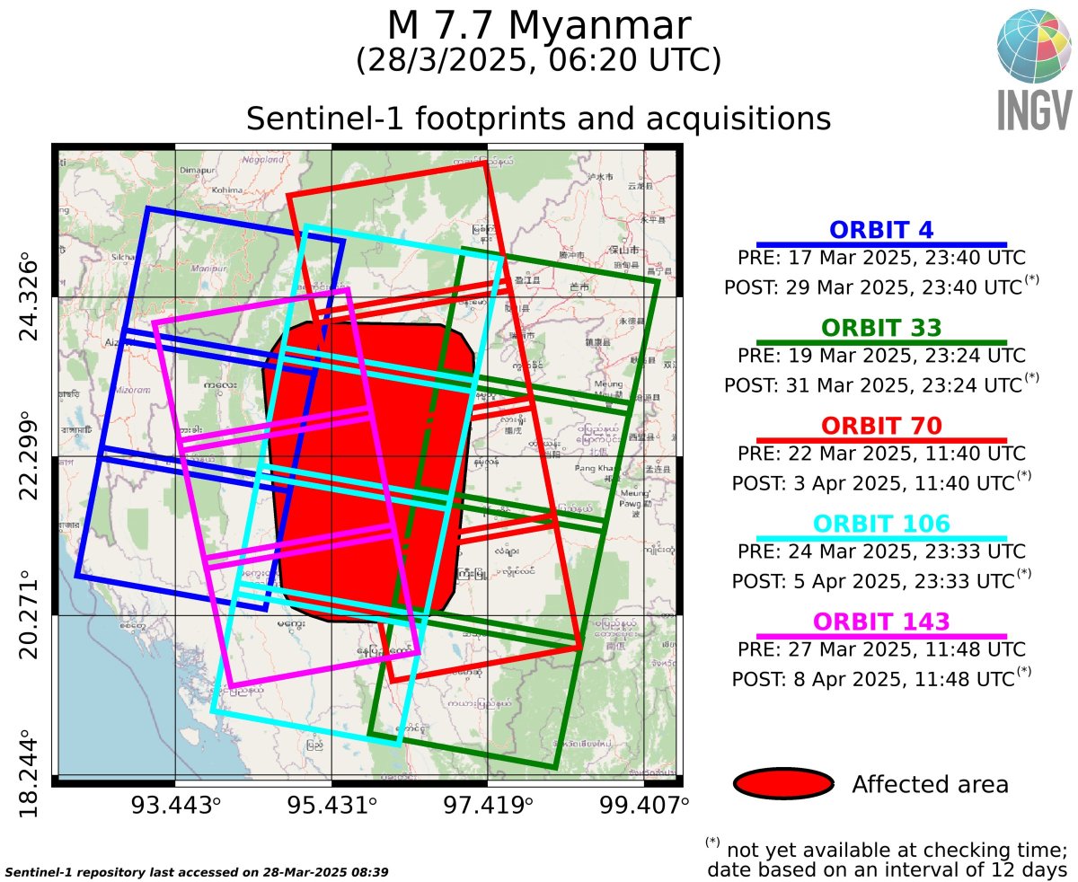
Scenario (**NOT REAL DATA**) of deformations for the
today M 7.7, #Myanmar #earthquake (up to 1 m on surface), based on #USGS finite-source results.
Here also the #Sentinel1 acquisition schedule for #InSAR results
https://t.co/Pn25Vl2eqg
with @antandre71 https://t.co/FNQMO3mpzs
Mar 28
Geohazards Exploitation Platform
Reposted

We have collected a number of images from eyewitnesses
of the #Myanmar earthquake, the link is below
https://t.co/BoKETGvh2z
Mar 28
Geohazards Exploitation Platform
Reposted

#EarthquakeReport for M7.7 #Earthquake in #Burma
Right-lateral strike-slip mechanism
High intensity
@USGS_Quakes models suggest triggered landslides and
induced liquefaction
Read 2018 report https://t.co/mNs41cWKvy
https://t.co/QwlkbG1Sck https://t.co/GlAQ0vMOmA


Mar 28
Geohazards Exploitation Platform
Reposted

Notable quake, preliminary info: M 7.7 - 16 km NNW of
Sagaing, Myanmar https://t.co/g2nXJYU6eI
Mar 28
On the Blog: Santorini Volcano Experiencing Another
Unrest Phase
@CopernicusEU Sentinel-1 Line-of-Sight (LOS) motion rates
for the period 07/2024-12/2024, from both the ascending and descending orbital tracks
https://t.co/k4Axgedxtu
Feb 4
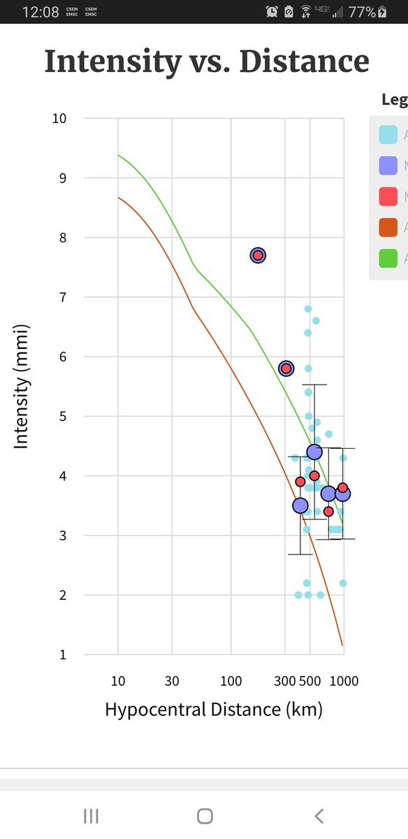
Geohazards Exploitation Platform
Reposted

Mw=7.1, OFF COAST OF NORTHERN CALIFORNIA (Depth: 11 km),
2024/12/05 18:44:19 UTC - Full details here: https://t.co/zoNYz8gatA https://t.co/4hqmZnF8cF
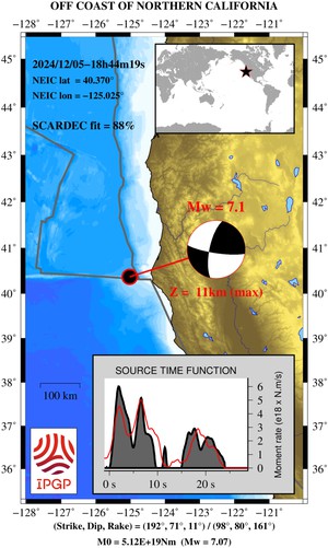
Dec 5
Geohazards Exploitation Platform
Reposted
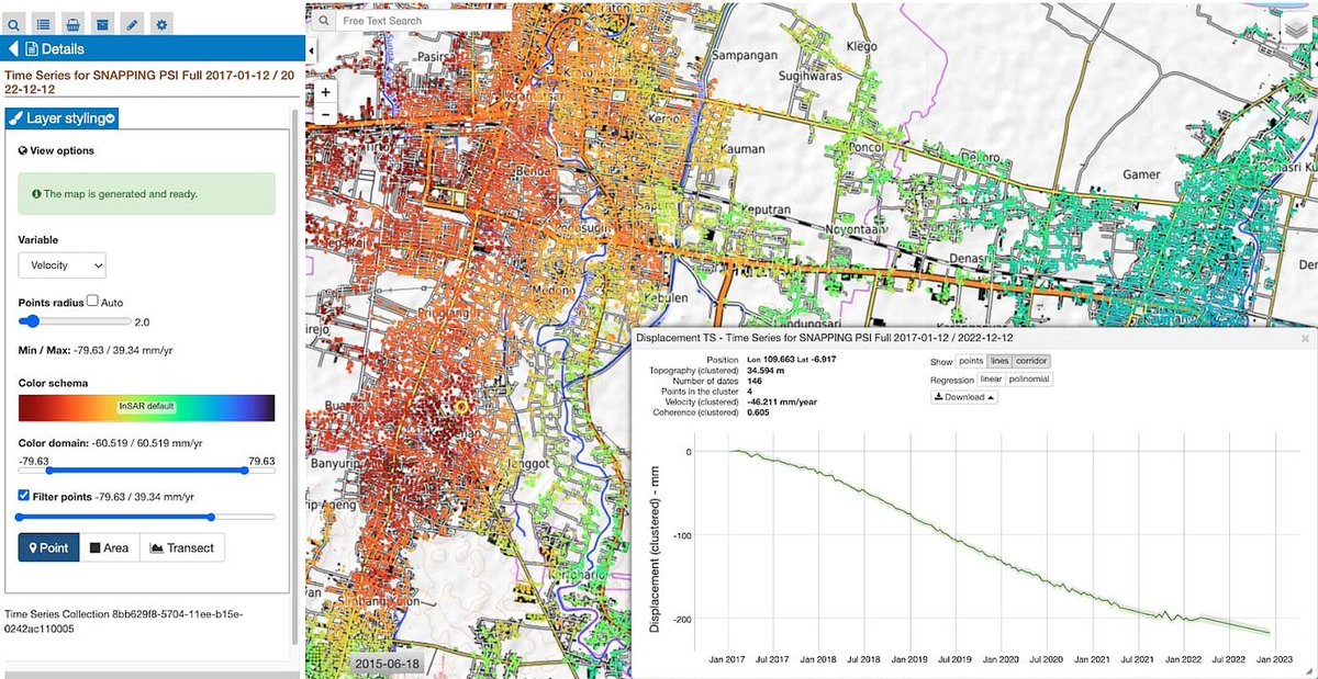
On the blog: Unlocking Geohazards Monitoring with EGMS
on GEP.
Accessing @CopernicusEU EGMS products through GEP provides key
features, implemented on purpose to support geospatial data analysis.
https://t.co/F0dkVj3b14 https://t.co/wk4TB2lgTa

Jun 3
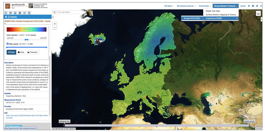
Geohazards Exploitation Platform
Reposted
EGMS Ortho (Level 3) Vertical Component available on
GEP, covering the reference period from 2018 to 2022.
Accessing @CopernicusEU EGMS products through GEP provides key
features, implemented on purpose to support geospatial data analysis.
Read more:
https://t.co/55fGUXq1DA https://t.co/4OAHc1ZD0T
Jun 3
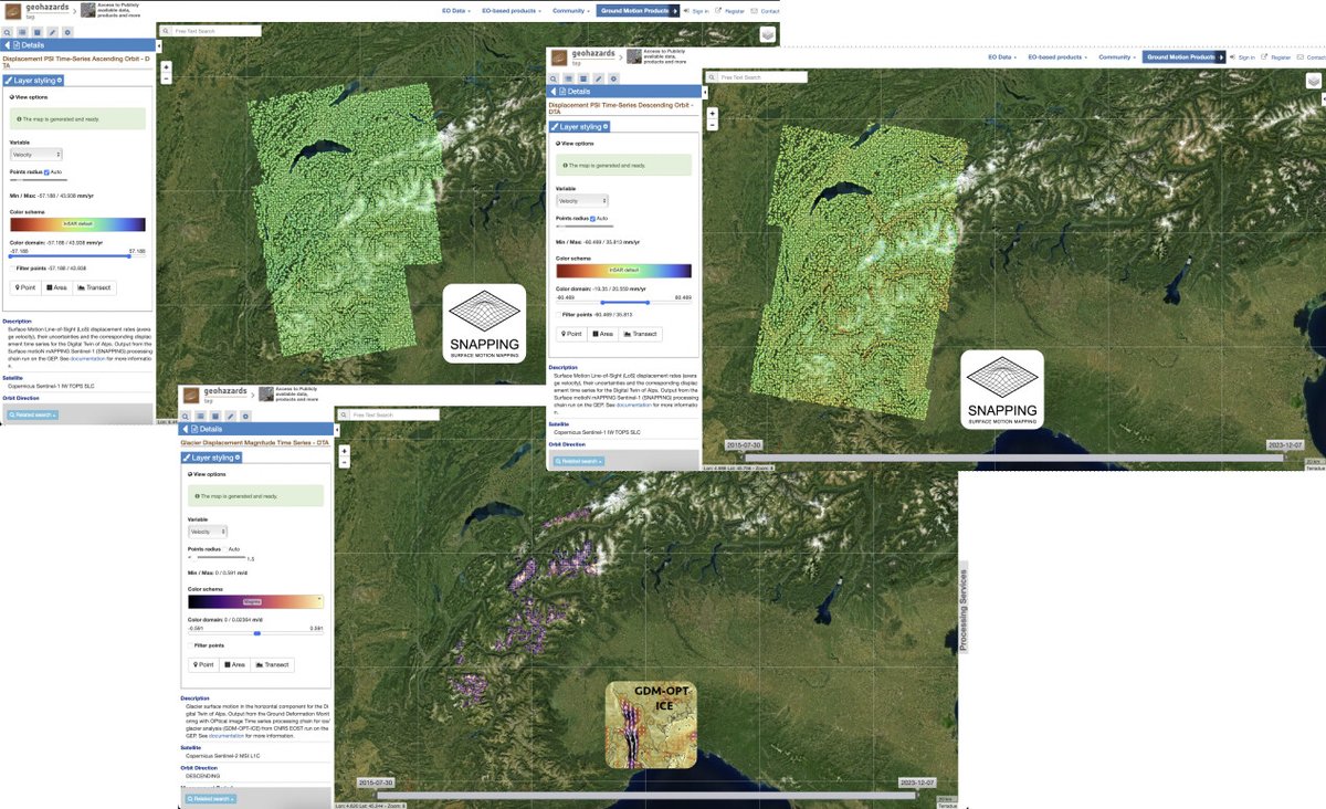
Geohazards Exploitation Platform
Reposted
On the Blog: Ground motion products for glaciers and
landslides monitoring, processed over the eastern Alps
https://t.co/LhTjrwOe2L https://t.co/DYrh1c8nan
May 7